
September Forecast
EARLY AUTUMN SUMMARY
By and large, the first half of October has done almost a complete 180° turn towards Autumn weather in just two days, and a series of fairly moderate storm systems this week could help seal the deal.
Starting this weekend, a blocking pattern of high pressure over the East Coast, north Atlantic, and Russia will help lock in a mostly low pressure regime over western Oregon for at least the next 15–18 days, or so.
Two stratospheric polar vortex (SPV) disruptions are imminent with the first already affecting the lower polar stratosphere. But, as usual this early in the season, the higher levels will NOT be severely disrupted.
More consistent high pressure may not return until the last two weeks of October.
FOUR-WEEK FORECAST

A series of fairly moderate storm systems will impact Oregon early next week– the first being a long atmospheric river, and the second looking more cyclonic with possibly more rain.
Breezy winds are possible on Sunday by mid-afternoon. Eugene could see precipitation as early as Monday morning, with around 0.15–0.25 inch total rainfall for the atmospheric river.
The more cyclonic system for Tuesday currently has a larger range of total rainfall, roughly 0.20–0.50 inch.
Gusty winds up to 25–35 mph are possible on Tuesday by late morning and all afternoon. Breezy conditions are also possible on Wednesday and Thursday afternoons. (Another system could arrive late Thursday.)
Widespread gale-force winds are also likely all day Tuesday all along the Oregon coastline, along with high seas. There’s an elevated threat for sneaker waves through Tuesday night for anyone along the Oregon coast.
Next weekend could end up dry with high temperatures in the low 70s, followed by what looks like a mixed and unstable period.
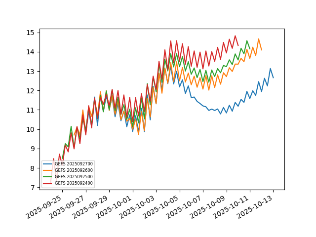
A mild SPV disruption from Siberia already underway may not have much effect around here. Siberian snow cover is extensive and Arctic sea temperatures are near normal north of east Siberia, both of which should help to channel the disruptive Ural Basin high directly across the central Arctic atmosphere. If this happens, I would not expect a significant cold air mass to reach us.
Any possible impacts on the Pacific Northwest, if any, would probably be delayed until at least October 10–12. But that’s also about when the next stormy period will arrive.
Now, the second SPV disruption is more uncertain and could be stronger, so I wouldn’t discount any possible Northwest impacts shortly after October 15–16.
After that, a resurgence of high pressure may bring seasonably warm and dry weather heading into late October, just as global wind speeds are predicted to increase.
SEASONAL TRENDS
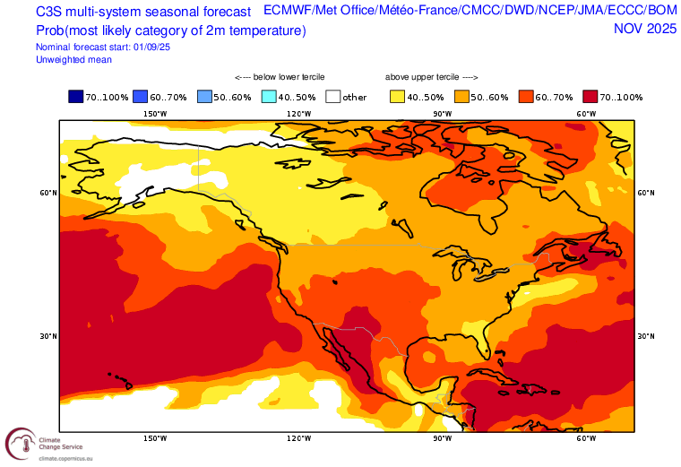
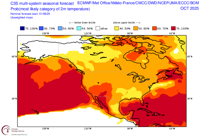
The Copernicus C3S seasonal forecasts expect the extreme north Pacific marine heatwave to continue promoting generally elevated air temperatures across the southern Pacific Northwest through the rest of Autumn.
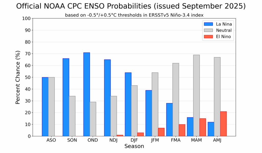
And the Climate Prediction Center is predicting La Niña conditions will develop rough by mid-Autumn and should last into mid-Winter, at least. And a return to El Niño is not out of the question by next Summer.