
FEBRUARY WEATHER FORECAST
FEBRUARY WEATHER FORECAST
ATMOSPHERIC SUMMARY
With Valentine’s Day still on my mind, I woke up before dawn last Wednesday as the outside temperature dropped below 30°, curled up in a tight ball—evidence of the wintry cold snap I sketched out last month. I thought about the thermal conservation of the fetal position and what that suggests about ancient fertility symbols and quickly realized what an apt, multi-layered metaphor this is for the overall situation across the northern Pacific.
One of my subversive aspirations is to humanize and soften the edges of the “hard sciences”, but I also want to be mindful of my male privilege as I nurture this motherly metaphor.
An immediate case in point is how the early February polar vortex disruption was the catalyst for the February 15th–20th cold snap, which in turn set up the Pacific Northwest for a tightly coiled hurricane-force cyclonic storm which will drive rainy weather into Oregon for several days.
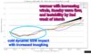
As I thought about this prospect, and global westerly winds increasing into the middle of March, the MJO oscillation moving east into open tropical Pacific waters– inducing the demise of La Niña and giving birth to neutral ENSO conditions –and the sweet sunrise of a nascent Spring, the subseasonal profile seemed pregnant with profuse propensities.
FOUR-WEEK FORECAST
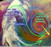
In my January forecast, I suspected that around February 20 the general weather pattern, “will begin to shift towards milder, more Spring-like weather”. But, it’s likely that a recent strong polar vortex disruption will have a significant impact towards the middle of the coming week and beyond.
And, this weekend a large storm front across the entire Gulf of Alaska is predicted to contract into a 975 millibar cold-core cyclone west of Vancouver Island by Sunday morning. And, as I’m writing this, that front is already cannibalizing ample moisture from a very large atmospheric river pushing north through the Bering Sea.
With the cyclone pulling it north, an atmospheric river will arrive here early Sunday morning. Rainfall that morning could be moderately heavy, with perhaps a milder surge overnight.
Winds along the central Oregon coast could gust to over 40 mph late Sunday night, with 70+ mph wind gusts along the southern Oregon Coast Range.
Rain continues throughout Monday, Feb. 23 with heavy rain by afternoon and and overnight as another cyclonic system currently ~1500 miles west of northern California feeds deeper moisture into the atmospheric river.
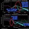
Showers should slowly diminish through the day on Tuesday, ending late. This will probably be followed by the impact of a strong stratospheric polar vortex (SPV) disruption with several drier days and near freezing overnight temperatures, possibly continuing into March 1–2.
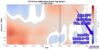
A warming trend within the first several days of March could include infusions of subtropical heat and limited moisture, especially as we approach the second week. This might dovetail with a mild polar vortex disruption impact around March 8–10 and increased instability.
But, around March 11–12 into the third week conditions could improve again towards milder, more Spring-like weather.
The Final Warming of the polar vortex could occur by early March, with extended impacts around March 15–25. But there’s a chance that the Final Warming will be delayed into late March. (I’m not sure which will happen.)
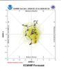
Around March 20, as the tropical Madden-Julian Oscillation (MJO) moves across the Pacific, a somewhat more showery pattern could redevelop, BUT some models are leaning towards little or NO tropical convection, returning the MJO to the Indian Ocean towards the end of March.
ENSO FORECAST
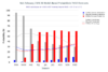
The North American Multi-Model Ensemble average favors ENSO-neutral conditions within the February-to-April 2026 timeframe (60% chance)– conditions that may persist well into summer. For late summer and beyond, there is a 50–60% chance for onset of a weak El Niño, although model uncertainty remains significant and ENSO forecasts made at this time of year tend to have lower accuracy (the Spring Predictability Barrier).
ENSO-neutral conditions will likely persist into June-through-August 2026 (56% chance).
A series of oceanic Kelvin waves and atmospheric Rossby waves have pushed a long plume of subsurface heat into the central Pacific and some climatologists think the Indo-Pacific warm pool among the southwest Pacific archipelagos contains enough heat to sustain the coming El Niño through the end of 2026.
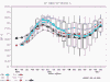
And, sadly, there are recent indications for a resurgence of El Niño in early 2027. But again, long-term ENSO forecasts are generally more precise as Spring gets underway.
GRAPHICS CREDITS—
• Dr. Victor Gensini, Northern Illinois Univ.
• NOAA GOES-West satellite
• stratobserve.com
• Dr. Judah Cohen, JANUS Research Group
• European Center for Medium-Range Weather
• NWS Climate Prediction Center
• NWS Climate Prediction Center