JUNE WEATHER FORECAST
ATMOSPHERIC SUMMARY
Long-term forecasting is very challenging in the best of times. But this El Niño is now on track to become the world’s strongest on record, sending quite an enormous amount of thermal and kinetic energy across the eastern Pacific and ultimately throughout the global atmosphere.
This increased energy translates to a greater variety of summer weather with shorter term volatility, as exemplified by the El Niño itself (see El Niño Forecast). One could be justified to conclude that this summer will NOT play out the way most El Niño summers typically do– EXCEPT for the hotter conditions.
In general, I would expect conditions to steadily get warmer and for mostly very dry conditions to persist through nearly all of July, especially after July 10–12.
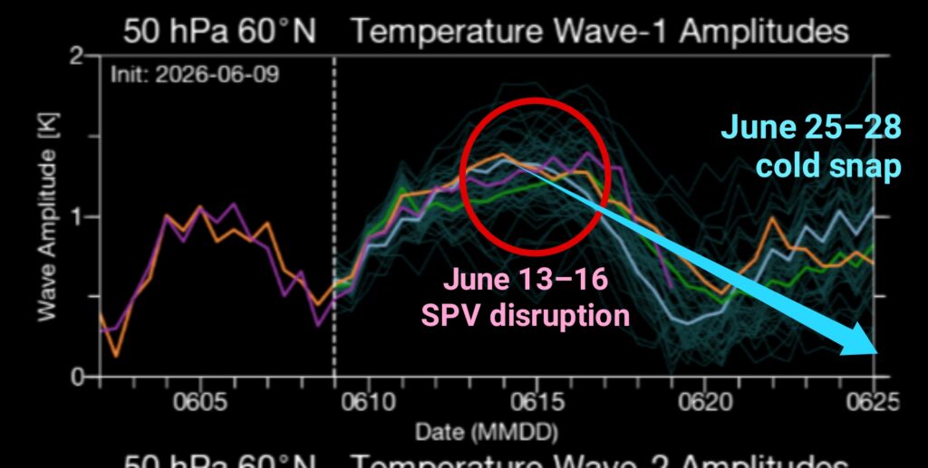
● (50 hPa Wave-1 temperatures)
THREE-WEEK FORECAST
It may sound a bit fishy, but a major cause of our recent colder weather was a June 13–16 disruption of the northern stratospheric polar vortex (SPV).
(Incidentally, that same SPV disruption also contributed to massive wildfires in the upper Colorado River Basin as relatively cold, dry air clashed with a more humid, convective airmass where the polar and subtropical jet streams merged over the Four Corners region.)
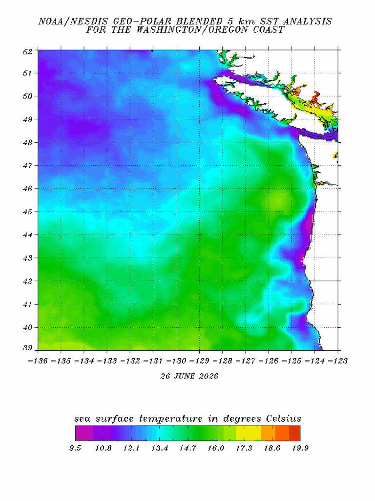
● (WA-OR coast sea surface temperatures)
Along its way here, the dry sub-Arctic airmass also picked up a convective upper-level circulation along the British Columbia coast, enhanced by a plume of 60°+ sea surface temperatures off the OR-WA coasts. By the time you read this, though, that system will mostly be on its way out.
As we head towards July, cloudy conditions will gradually decrease, while temperatures slowly recover towards the mid-70s. More summery weather in the 80s is likely by next weekend (July 3–5), but I wouldn’t rule out a day of weak scattered showers shortly before that.
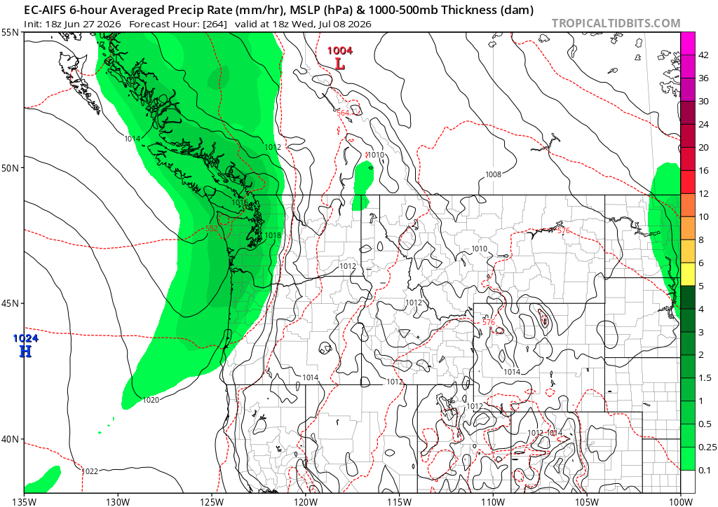
● (AIFS precipitation rate)
Some models suggest that one or two low pressure systems will impact the Northwest around July 8–10, including both the ECMWF AI Forecast System (AIFS) and velocity potential charts.
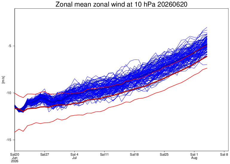
● (10 hPa zonal winds)
One sign of the shift towards more consistent summer weather is how the SPV winds reached their annual low point on the Summer Solstice, June 21– which is unusually early.
Stronger westerly winds in the tropical atmosphere, in conjunction with El Niño, will generally help to maintain a strong polar vortex, for awhile at least, and this in turn will allow for warmer weather in the mid-latitudes.
Various indicators, including very high global winds, also point to a significant warming trend after about July 10–12. That period could easily include a fairly strong heatwave lasting several days.
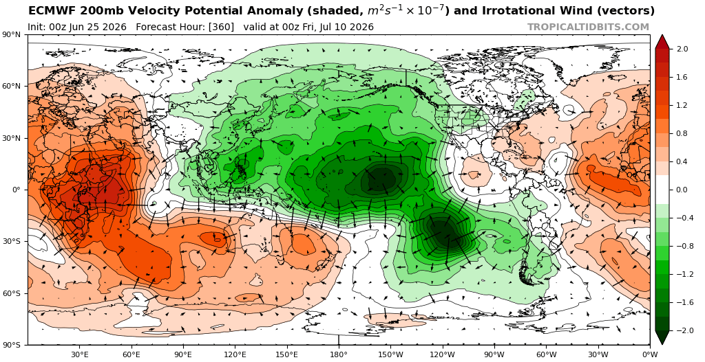
● (velocity potential anomaly)
EL NIÑO FORECAST
AND, speaking of July 10, some velocity potential and Madden-Julian Oscillation (MJO) charts suggest renewed tropical cyclone activity in the north & south central Pacific beginning around July 10–15, and their wind fields are expected to help kickstart the next round of Westerly Wind Bursts (WWBs).
These WWBs typically induce downwelling Kelvin Waves that shift large amounts of subsurface ocean heat across the tropical Pacific towards Central and northern South America.
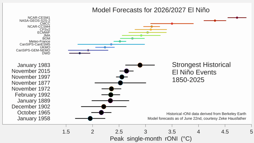
● (El Niño model forecasts)
7 of the 13 primary ENSO forecast models now predict the 2026–27 El Niño will exceed 1982–83 in terms of the relative Oceanic Niño Index (rONI or RONI). And that means it could be the strongest El Niño that nearlyvall humans have ever experienced.
(RONI is used to make a more relative comparison between ENSO events by basically subtracting the effects of global warming.)
The NOAA Climate Prediction Center projects well above average temperatures across Oregon and Washington during July-August-September (as does ECMWF) and that at least moderate El Niño conditions will persist into the first four months of 2027.
GRAPHICS CREDITS:
• stratobserve.com
• NOAA/NESDIS
• ECMWF
• ECMWF
• ECMWF
• Zeke Hausfather